
Warning tropical cyclone will become ‘more intense’ as it crosses coast
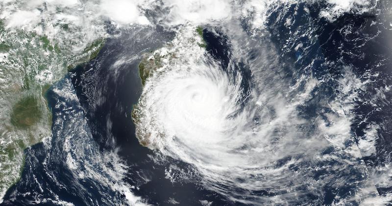
Queensland authorities say Tropical Cyclone Jasper is expected to make landfall as a category 2 storm later today, with conditions expected to worsen as wind speeds of up to 140km/h and widespread heavy rainfall last the state’s far north.
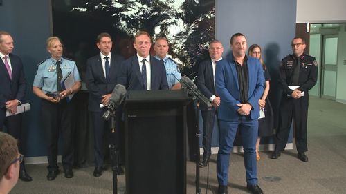
Deputy Premier Steven Miles and emergency services chiefs gave an update on the storm that is about 140kms east of Cairns.
He said conditions in the state’s far north will grow “more intense” over the coming hours as the storm crosses the coast between Hope Vale and Cairns.
“Tropical Cyclone Jasper will head the Far North Queensland coast earlier this afternoon and this evening,” Miles said.
“It is expected to make landfall this afternoon and into this evening. While currently it remains a category 1, it is still expected to intensify to a category 2 system.”
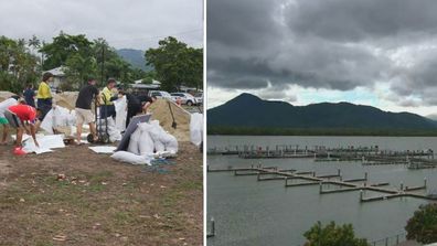
Between 3pm yesterday and 6am today, the SES responded to more than 80 calls for help. There are 93 people currently in evacuation centres.
Miles, who is set to become Queensland premier later this week, said he will travel to Cairns.
Senior meteorologist Laura Boekel, from the Bureau of Meteorology, said the storm is currently about 140km north-east of Cairns, but winds of up to 82km/h have already been recorded in the city.
“We are starting to see the impacts of the cyclone and that will get worse as we move through today and as that crossing becomes closer.
“We have a warning current for Cape Melville to Cardwell and that extends inland to the Atherton Tablelands and Palmersville.”
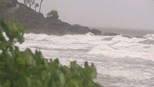
She confirmed that damaging winds of up to 140km/h should be expected.
“With winds of the speed and this category system we can see trees starting to fall down, including large trees, and any unsecured items can be moved around as well.”
Boekel said Cyclone Jasper is unlikely to develop into a category 3 storm.
Flooding remains a major concern for authorities, with rainfall over six hours expected to total 250mm to 300mm and totals for the next 24-hour period forecast between 400mm and 500mm.
Police Commissioner Katarina Carroll said additional water police have been deployed to the area “just in case”.
“If you don’t need to be out and about, please stay away from the roads,” she said.
“As always, if it’s flooded, please, forget it.”
Cairns Mayor Terry James told Today this morning the risk of the a tidal surge had lessened but powerful winds were still expected in the region.
“We will still get gusts, you know, potentially up to 140km/h and a lot of rain, that’s what we are expecting at this stage.,” he said.
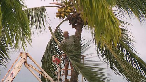
Locals well-accustomed to cyclones have been preparing for days, clearing debris and loose items, filling sandbags and yesterday stripping supermarket shelves in Cairns.
There are also concerns of flooding in areas close to beaches due to the high tide in some parts later today, the bureau warned.
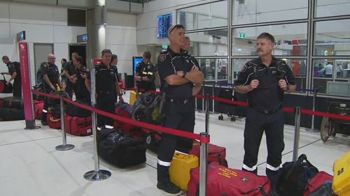
Authorities were preparing long before the storm hit. A pre-emptive disaster declaration was made yesterday for the area between Cape Melville and Townsville, as emergency response teams flew in from Brisbane.
The impending cyclone has also disrupted long-awaited holiday plans.
Sandbags, supplies and evacuations as Jasper moves in
Several airlines cancelled and rescheduled flights even before Cairns Airport closed at 8pm yesterday.
“Do not come to the airport because the airport terminals will physically be barricaded with sandbags,” chief executive Richard Barker said.
“The runway itself will be available for emergency services but there are no scheduled flights.”