Cyclone likely to develop within 24 hours as it nears Queensland
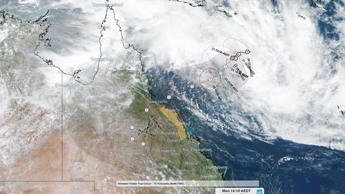
A tropical low off the coast of Queensland will develop into a cyclone within 24 hours as disaster preparations are hastily underway.
The Bureau of Meteorology, in its latest update, warned tropical Cyclone Kirrily would develop as early as tomorrow morning.
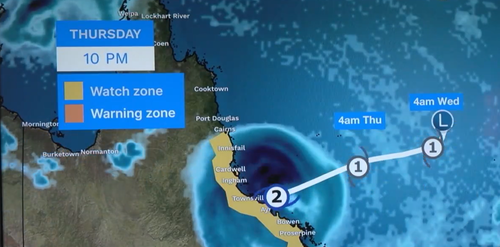
It is now expected to make landfall between Cardwell and Airlie Beach as a potentially downgraded category 2 storm on Thursday night or Friday.

“It will continue to move west, south-west, towards the Queensland coast and by late in the day Wednesday, early Thursday, that’s when we expect to see winds and rain increasing across our initial our tropical cyclone watch zone,” meteorologist Miriam Bradbury said.
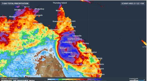
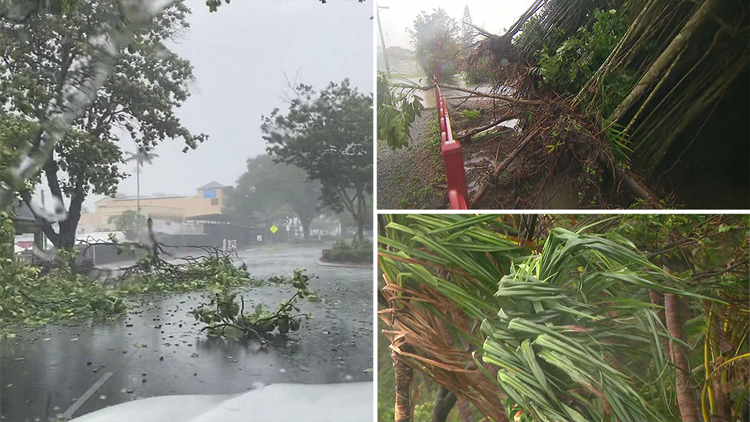
“We could see heavy falls, flash flooding and damaging wind gusts developing in that area leading to property damage, road closures and possible power failures.”
A watch zone is in place from Cairns to St Lawrence, which included Townsville, Mackay and Whitsundays Islands.
The tropical low, however, has since slowed and is now expected to significantly weaken after it makes a severe impact on the coast as a cyclone.

The bureau is anticipating the cyclone to then downgrade into a tropical low as it travels inland by Friday night into Saturday.
“In its wake, we may see continued significant flooding and continued dangerous marine conditions as well,” Bradbury said.
Residents within the watch zone are urged to prepare long-life food and water supplies, fill up their vehicles with petrol and have a power pack at home as it could take emergency services up to 72 hours to reach devastated towns.

The system is currently located over the central Coral Sea, roughly 860 km to the east-northeast of Townsville.
Queensland Fire and Emergency Services from across the state are heading up north to assist in preparation of the incoming disaster.
Residents were assured the state’s power supply is prepared to cope with the impacts.
Queenslanders are advised to stay up to date with forecasts and warnings.


