Cyclone Jasper to bring ‘gale-force winds’ and heavy rainfall to Far North Queensland
Cyclone Jasper is expected to cross the coast in Far North Queensland as a category 2 cyclone on Wednesday, bringing gale-force winds and heavy rainfall.
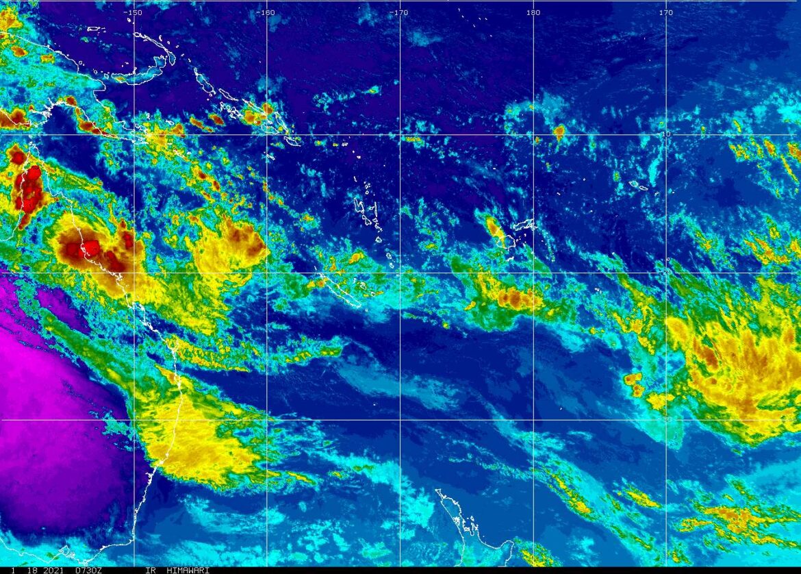
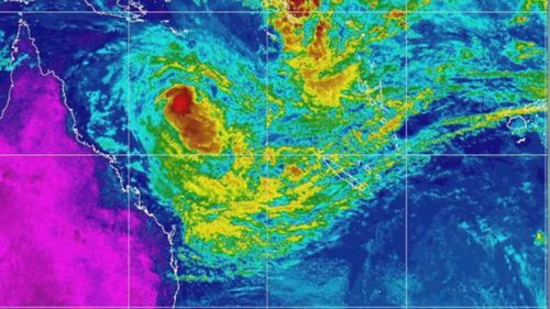
The tropical cyclone is currently sitting off the coast between Cairns and Townsville as a category 1 after it weakened overnight, according to the Bureau of Meteorology (BoM).
BoM predicts the cyclone will hit between Cape Flattery and Cardwell, but towns along the tropical Queensland coast between Cooktown and Innisfail, including Cairns and Palm Island, are within the warning zone.
“We can expect impacts from the cyclone within 24 hours including gale-force winds,” meteorologist Laura Boekel said.
“There are large amounts of rainfall associated with cyclones and this cyclone included.”
She said low-lying areas were especially vulnerable and should expect flooding.
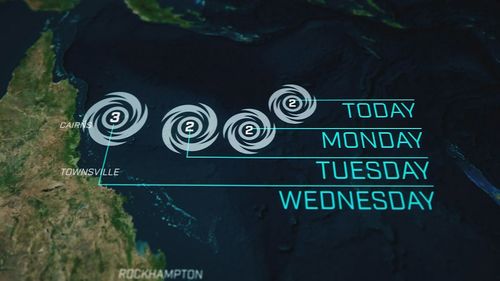
If the system is slower and crosses overnight on Wednesday or Thursday, there is a slim chance of it crossing as a category 3, according to BoM.
Rainfall totals between 100 to 150mm is expected every six hours or 350mm in 24 hours is possible near Cardwell.
Damaging winds up to 90 km/h hours are expected between Cooktown and Townsville (but not including Townsville).

The state’s emergency responses are on alert, with BoM to release an update every three hours.
Queensland Police Commissioner Katarina Carroll said 45 officers from the south would be deployed to the north, to assist vulnerable areas in preparation.
Carroll said it was currently school holidays so more people were travelling on the roads.
“There will be a lot of rainfall in a short amount of time, which obviously leads to flash flooding,” Carroll said.
“If it is flooded please forget it.”
Residents are urged to be prepared to shelter for 72 hours and have their emergency kits ready.
Many towns are expected to lose power supply in the cyclone.
Yesterday Cairns Mayor Terry James said the city hadn’t had a direct hit for 67 years so they were “overdue”.
The Cairns ferris wheel has already been packed down but it’s the crucial infrastructure that’s of greater concern.
Residents are being warned of king tide surges, which are likely.
Cyclone Yasi was the last major cyclone to hit Queensland, near Mission Beach about 130kms south of Cairns, and was a category five at its peak in 2011.