Severe thunderstorms sweep through Northern Territory as Cyclone Tiffany crosses Top End
Northern Territory residents have described ferocious thunderstorms and pelting rain caused by Topical Cyclone Tiffany as the extreme weather system continues to sweep through the state’s Top End.
Peter Pitcher, from Finnis Valley, 111 km south of Darwin, was nearly knocked off his feet when a huge bolt of lightning struck the ground near his property.
“I was kind of expecting it. Lightning was going off everywhere and from where I am it gets crazy,” Mr Pitcher said.

“I have been floored by lightning twice while living here, no direct hits, just enough to knock me off my feet. It hurts but is kind of euphoric,” he said.
Derek Quong, from Darwin, also awoke to dramatic thunderstorms but said extreme weather is just part of the Northern Territory’s regular wet season.
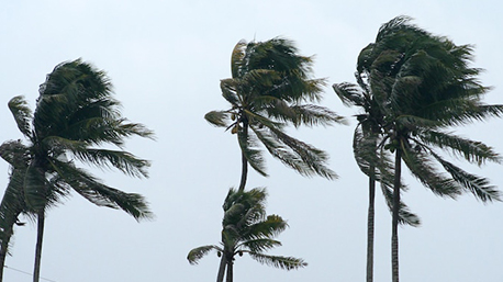
“It was about 6am when I got up and the wind was blowing, lightning, thunder. The palm trees were blowing a bit and then some heavy rain started,” Mr Quong said.
“I was born here and have lived here for 56 years I’ve been through a few cyclones. You make sure everything that could fly away is put away or in shelter.”
Cyclone Tiffany hit the Northern Territory’s east coast this morning, as communities in the firing line braced for heavy rain, thunderstorms and damaging winds.
\
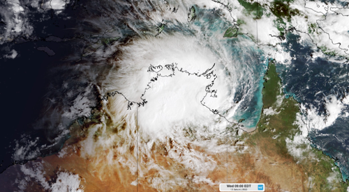
The cyclone was initially expected to gain ferocity as it crossed the warm waters of the Gulf of Carpentaria this morning but reformed as a category one cyclone.
“While there were signs that Tiffany could reach the Groote Eylandt as a category three severe tropical cyclone, the system moved faster than anticipated and instead arrived at the Top End’s east coast as a category one tropical cyclone on Wednesday morning,” Weatherzone meteorologist Ben Domensino said.
The storm made landfall at Port Roper this morning at 9.30am, heading west at speeds of 27km/h, with 100km/h winds at its centre.
“Tropical Cyclone Tiffany has also caused heavy rain and thunderstorms over the Top End and its islands during the last 24 hours. This rain and storm activity has come directly from the tropical cyclone,” Mr Domensino said.
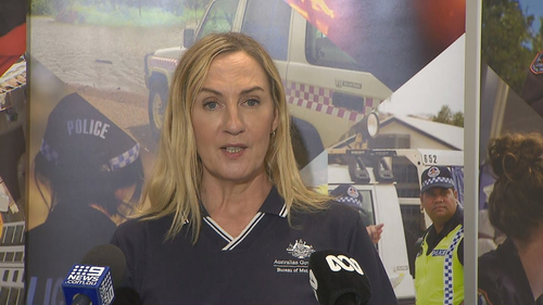
BoM meteorologist Jude Scott said while the cyclone is weakening in strength it would continue along the Top End throughout the week.
“Although the cyclone threat is easing, heavy rainfall, flooding and damaging winds remain hazards right across the Top End for the remainder of this week and into the weekend,” Ms Scott said.
She added rain totals are expected to reach 50-100mm a day, with chances of 200mm showers in isolated regions.
Flood warnings will be updated by the BoM and local emergency services as the path of the cyclone becomes clearer.
“It’s forecast to move quite quickly,” Ms Scott said.
“It’s expected with this heavy rainfall there will be rivers rising across the Top End.”
Several communities in the Northern Territory, including the Carpentaria region, are on flood watch.
“We will be in a vigorous active monsoon phase for the rest of this week and into this weekend,” Ms Scott said.

Northern Territory police assistant commissioner Janelle Tonkin said the need to evacuate regions in the cyclone’s path remained unlikely.
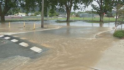
She said NT residents should drive to the conditions with their headlights on and always avoid flooded roads.
“I take this opportunity to remind Territorians it is absolutely not worth it to cross,” Ms Tonkin said.
Warnings for Groote Eylandt, initially believed to be in the cyclone’s firing line, have been cancelled.
Ms Tonkin confirmed there have been no injuries, and no reports of building damage as the cyclone hit the coast.
Northern Territory Emergency Service has advised residents in these areas to stay indoors as the storm hits and to beware of debris, fallen power lines and flooded roads.
Darwin is expected to post its coldest January day on record today, hitting just 22.8 degrees this afternoon.
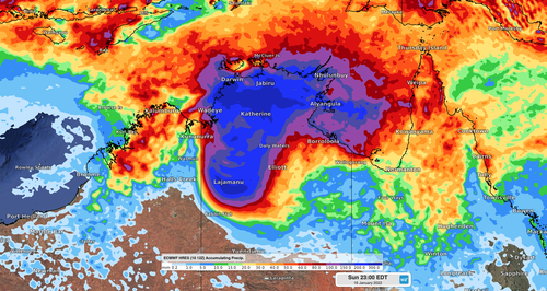
Cyclone to churn dangerous tides
Dangerous storm tides from the cyclone, creating hazardous waves and flooding, are predicted to impact Port McArthur and Alyangula, including Groote Eylandt.
“Tides are likely to rise significantly above the normal high tide in coastal areas close to and south of the system track, with damaging waves and dangerous flooding possible,” the Bureau of Meteorology warning read.
“Heavy rain is expected across parts of the Arnhem and Carpentaria Districts and is expected to cause flooding of low lying areas and river rises. Heavy rain is also likely to extend westwards into the Daly District on Thursday.”
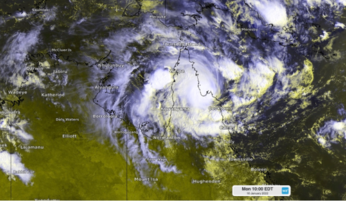
Tropical Cyclone Tiffany initially made landfall in Queensland, hitting the Cape York peninsula with ferocious winds as it made its way towards the Northern Territory.
It’s the first tropical cyclone to cross Australia’s coast this year.

In Queensland, the town of Maryborough and surrounding areas are still recovering from heavy flooding, triggered by the aftermath of ex-tropical cyclone Seth.
Two people, a 52-year-old man found in a Tiaro river and a 22-year-old Sunshine Coast man, have lost their lives, while searches continue for a 14-year-old girl, also believed to have died in the floods.

