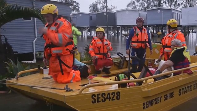
Flash floods, towns evacuated and dams on the brink of spilling over as wild weather slams NSW
A rain bomb is slowly pushing down the NSW coastline, leaving a trail of flash floods and destruction in its wake.
Multiple warnings and evacuation orders are still in place for the NSW mid-north coast amid fears of record flood levels and overflowing levees, with authorities warning the situation could be life-threatening.
Sydney is next in line with some areas predicted to cop more than 150 millimetres of rain on Saturday.
Sydney’s waterways are set to become danger zones, with up to four times as much rain from today predicted to fall in the next 24 hours.
Warragamba dam is expected to overflow at the weekend, as the deluge of rain expands from the worst-hit NSW Mid North Coast, to further south including the Hunter Region, Sydney and Illawarra.
The Mid North Coast has been pummelled by the powerful weather system, soaking the region and causing flash flooding and landslips.
Kempsey, added to the expanding list of evacuation orders on Friday night, had its heaviest rain in 47 years, with the town receiving 226 millimetres on Thursday.
Major flooding is taking place along the Gloucester River, with the expected peak of 5.8 metres set to come at 6am on Saturday.
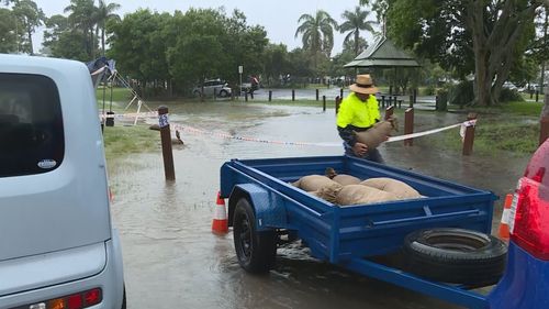
Late into the evening Port Macquarie SES shared images on Facebook showing locals who turned up to fill sandbags and help them protect the community.
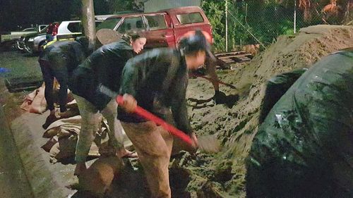
Residents in low-lying parts of Port Macquarie, Kempsey, Lower Macleay, and North Haven and its surrounds were all ordered to evacuate on Friday night. The deadline for evacuation has now passed.
Shortly after midnight, orders remained current for low-lying parts of Bulahdelah, and Wauchope and Rawdon Island, where major flooding was expected to surpass the record inundation from February 2013.
At Port Macquarie, parents ran the gauntlet to pick up their children from school early.
“(It was) really scary. I thought about staying down here and having my son get a ride home with someone else,” one mother said.
Where the rain has stopped falling, the damage is clear.
Landslips and buckling roads around Nelson Bay will require a big clean-up.
More than 2000 calls had been made to the SES since Thursday, when parts of the Mid North Coast saw almost 300 millimetres of rain — more than three months’ worth in just a few hours.
There were also more than 30 flood rescues across the state, with rainfall swamping roads and causing conditions forecasters say are “life-threatening”.

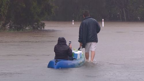
More than 20 rivers and catchments are under various levels of flood warnings, with some residents using kayaks to get around.
Residents living near the Myall River in Bulahdelah, north of Newcastle, were earlier told they might have to evacuate due to rising water.
Weather warnings now extend down to the Hunter Region, with Sydney and Illawarra due to see the worst on Saturday.
In the latest update, Bureau of Meteorology officials urged people to heed the warnings.
Sydney will see “dangerous” rain tomorrow, forecasters say, as the worst conditions continue to be on the NSW Mid North Coast.
“Very intense, very heavy, potentially life-threatening rainfall is happening on the Mid North Coast,” senior climatologist Agata Imielska said.
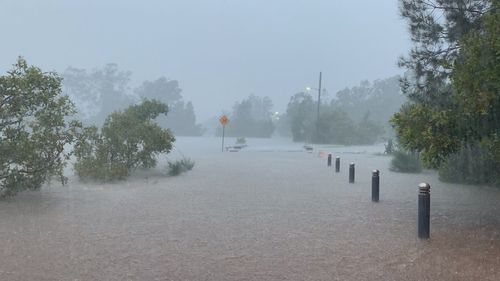
She said up to 100 millimetres of rain was falling every hour, making conditions “very dangerous”.
Ms Imielska said the focus remained in those areas facing dangerous floodwaters.
But rainfall would tomorrow be “substantially heavier and potentially more dangerous” as it moves south, she said.
“In Sydney, for example, we have seen some rainfall over the last few days. It is really important for Sydneysiders to be mindful, reconsider changing their plans,” she said.

