Sydney records coldest day in 37 years
Sydney has officially shivered its way through its coldest day in 37 years.
Metropolitan Sydney reached a maximum of just 10.3 degrees today, making it the coldest day overall since 1984.
Elsewhere in NSW blizzards dumped more than half a metre of snow over parts of NSW over the last 48 hours as towns and cities shiver through record-breaking temperatures.
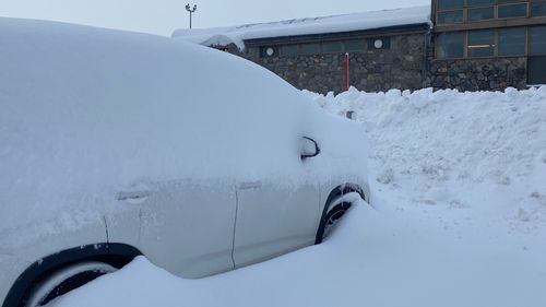
While city dwellers might be struggling through today’s icy weather, the conditions are barely comparable to temperatures in regional areas today with Cooma on track to record its coldest day in 17 years with a maximum of just 1.2C.
Mudgee is also on track to record its coldest day in nearly three decades with a top of 4.4C.
The last time temperatures dropped that low was in 1992, when the town recorded a minimum of 5.2C.
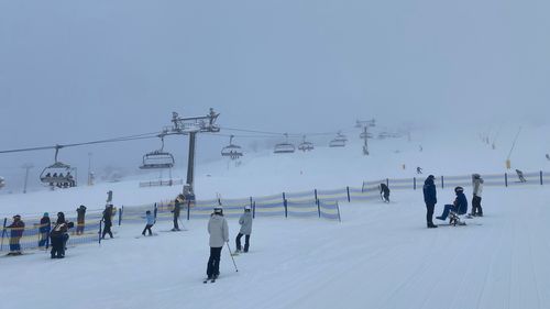
In the Central Tablelands, Orange has received its heaviest dump of snow since 2015 with a whopping 16cm falling today alone.
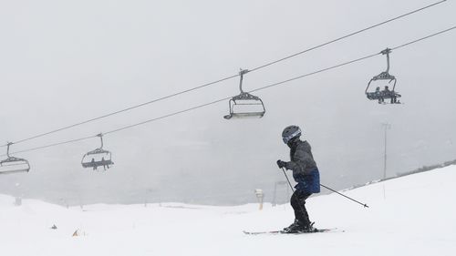
Fresh flakes hit the slopes throughout yesterday, with 15cm to 30cm of snow at some resorts by last night, including Thredbo.
Perisher Valley has already received around half a metre of snow over the last two days with more on the way today.
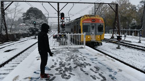
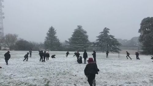
Snow is also falling across the upper Blue Mountains this morning with Katoomba, Blackheath and Mount Victoria receiving their first sprinkle of snow for the season this morning.
Frost risk is high to severe in most areas across the region with drivers warned of black ice and dangerous driving conditions.
Snow is expected to continue to fall above an elevation of about 900 metres in southern NSW this afternoon, with another 10 centimetres likely in the Alps, according to Weatherzone.
Locations at lower elevations including the lower Blue Mountains and Greater Sydney are forecast to receive showers today with temperatures in the city unlikely to get above 11C.
Drivers across NSW have been warned to postpone travel plans as the severe weather creates treacherous driving conditions in the lead up to the long weekend.
-
Adelaide
179 -
Brisbane
208 -
Canberra
132 -
Darwin
3118 -
Hobart
1411 -
Melbourne
167 -
Perth
2010 -
Sydney
166
The conditions come after severe wintry weather slammed much of Australia’s south-east, with damaging winds, heavy rain, thunderstorms, flooding, widespread snow, and hail overnight.
Several roads in the state’s Central West have been closed due to snow and ice.
The Mitchell Highway is closed between Northern Distributor Road in Orange and Millthorpe Road in Shadforth.
The Escort Way is closed between Northern Distributor Road in Orange and Peabody Road in Boree.
Chifley Road is closed between Bells Line of Road in Bell and Hartley Valley Road in Lithgow and Ilford Sofala Road is closed about 5km west of the Castlereagh Highway in Ilford.
A number of local roads in these areas are also closed.
Further south, a low is generating damaging winds, heavy showers, and small hail in Victoria and Tasmania.
Damaging winds which reached 100km/h carved a path of destruction across Melbourne overnight, with thousands of calls for help to the State Emergency Service.
23:55 EST


In the past 24 hours, there were more than 2000 reports of trees down, about 500 reports of trees down, about 500 reports of building damage, and about 150 calls for help in areas where there is severe flooding.
A severe weather warning is spanning across Victoria all the way from Sale to Ballarat.
South to south-easterly winds with gusts of up to 90km/h will continue across Melbourne this morning, decreasing to 25 to 40km/h in the afternoon and 15 to 20km/h in the late evening.
Another low is causing showers and storms in western parts of Western Australia with a severe weather warning in place today.
23:20 EST

Strong to gale force northerly winds are occurring along the west coast prior to the passage of the low.
Damaging winds with gusts up to 100km/h, abnormally high tides and damaging surf for Lower West and South West.
Localised wind gusts up to 90km/h are possible between Mandurah and Lancelin this morning with Cape Naturaliste recording wind speeds of 96km/h overnight.
A high is keeping elsewhere mostly dry and settled.


:contrast(2):saturation(1.16)/https%3A%2F%2Fprod.static9.net.au%2Ffs%2F6b994682-2ae5-4e77-8826-01f3fa748956)


